Shop
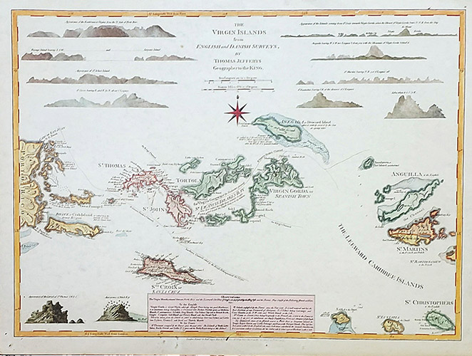
Virgin Islands 1775
$55
The Virgin Islands from English and Danish Surveys 1775
Cartographer: Thomas Jefferys
Originated as part of The West-India Atlas. In addition to the Virgin Islands, the map includes the Eastern part of Puerto Rico, Anguilla, St. Christopher, Saint Martin, Saba, and St. Eustatius. Features shoals, anchorages, and channels. Includes 12 island profiles with “Observations.” Printed after Thomas Jeffreys death in 1771.
Image size: 24″ x 18 1/4″
Paper size: 25 3/4″ x 20″
$10.00 shipping
Shipping is for the United States only.
For international, please email or call us to arrange method.
Shipping is for the United States only.
For international, please email or call us to arrange method.

